

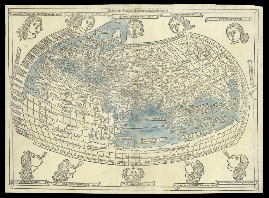
A highlight of MONA’s map collection is this woodcut world map, based on the geographical system of the second-century scholar Claudius Ptolemy. Published in Ulm in 1482 by Leonhard Holle and engraved by Johannes Schnitzer of Armszheim, who signed the work along the upper border: Insculptum est per Johane Schnitzer de Armszheim (Engraved by Johannes Schnitzer of Armszheim)—it is among the earliest printed maps of the world.
The map depicts Ptolemy’s classical conception of the world, with Europe, Asia, and northern Africa occupying most of the composition. Yet it also ventures beyond the limits of ancient knowledge: land extends below the Tropic of Capricorn, and a vast southern landmass joins Africa and Asia, enclosing the Indian Ocean. An inscription notes that these regions were “unknown to Ptolemy”—a quiet acknowledgment of the boundaries of classical geography and a reflection of the growing influence of medieval speculation and Renaissance curiosity.
This rare and historically significant map will be on display for conference attendees at MONA.